The Navajo Indian tribe is the largest tribe in the US with nearly 400 000 people belonging to this nation. They live on their native land, as it was considered useless by former US government officials. As a nation, they are partially independent from the US with their own police force and their own rules – which have to be followed. Their land spans over areas of Arizona, Utah, New Mexico and Colorado. As a Christmas present, David organised a six day long tour in Northern Arizona with the emphasis on the Vermillion Cliffs and the area around Lake Powell. Most of it was on Navajo Land.
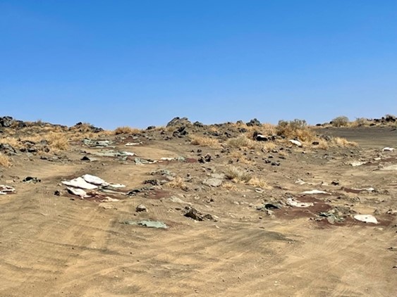
The trip from Phoenix to Page normally takes a bit over five hours – but we needed more than 9 hours. A severe forest fire north of Flagstaff forced us to take a detour. The navigator led us to an unmarked dirt road, which we followed for several miles. The road deteriorated continuously, leading into an area blanketed by black volcanic rocks. The snow capped mountains of San Francisco Peaks and the black smoke of the forest fire in the far distance together with the black volcanic rocks created a dramatic atmosphere.
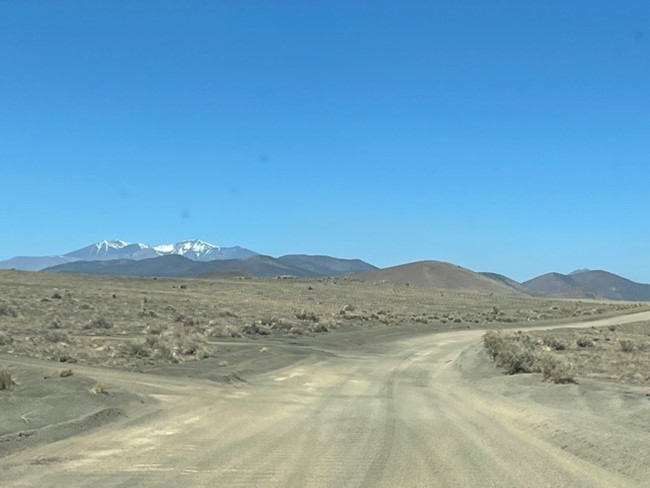
Snow capped San Francisco Peaks in the distance
Clouds of dust indicated that a few cars were behind us. At one point, a car which originally past us, came back, stopped with the driver shouting nervously: “You must turn around, the road becomes impassable!” We believed him and drove back to the main road which took us through Navajo and Hopi Land to Page. In Page, we heard that on the first day of the fire, a truck driver wanting to reach Page had to take a 40 miles long detour on dirt roads – we were lucky!
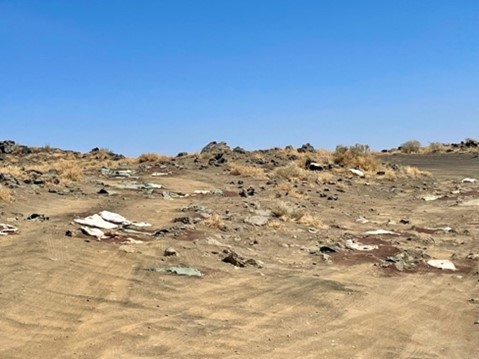
Nearly impassable dirt road covered with sharp lava rocks
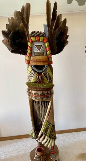
When driving through Hopi land, we stopped at a private house selling Indian art. I especially loved the Kachina doll above – it represents the mother of all Kachina dolls. Kachinas are spirits who express the presence of life in all objects in the universe. According to Hopi belief, they are supernatural beings who visit the Hopi villages during the first half of the year and live on the San Francisco Peaks near Flagstaff the rest of the time.
When we arrived in Page, a town founded in 1957 by workers building the Glen Canyon Dam, we were welcomed by my sister in law and brother in law, Billie and Ron, and Billie’s brother Scott, who lives and works in Page. His knowledge of the area was extremely helpful!
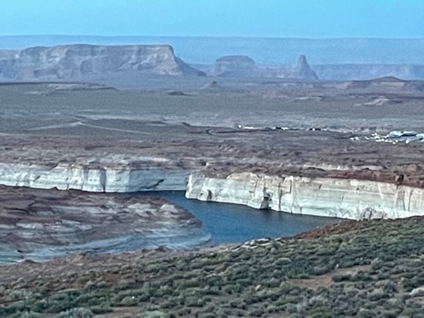
Damned up Colorado River
Very close to Page near the Glen Canyon Dam, two iron bridges span over the Colorado River. The space underneath the bridge is the favorite place for Condors to rest. The Condors were successfully bread after nearly becoming extinct in the beginning of the 20th century. In 1904, only 22 Condors existed in California. Now the Vermillion Cliffs counts 111. All Condors are marked and registered. The breading success is especially remarkable because a female Condor only lays one egg every two years.
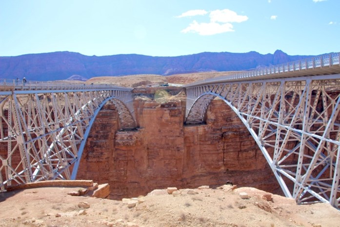
Navajo Bridge on the left side
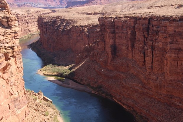
Colorado River
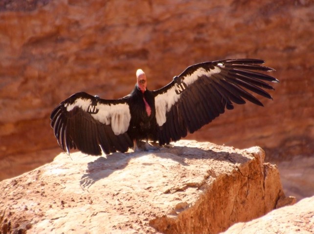
Male Condor attracting a female
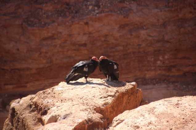
Successful attraction
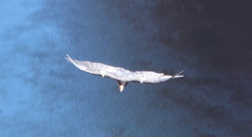
With wings spreading wide
the Condor soars in the sky –
Vermillion Cliffs
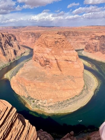
Horseshoe Bend
Scott took us onto the Vermillion Cliffs where only a four wheel drive can go. He showed us foundations of former Pueblo settlements and Indian graves. Pieces of Indian pottery were scattered over the ground. He found little white stones with a specific pattern, probably carved by Indian boys learning to make arrowheads.
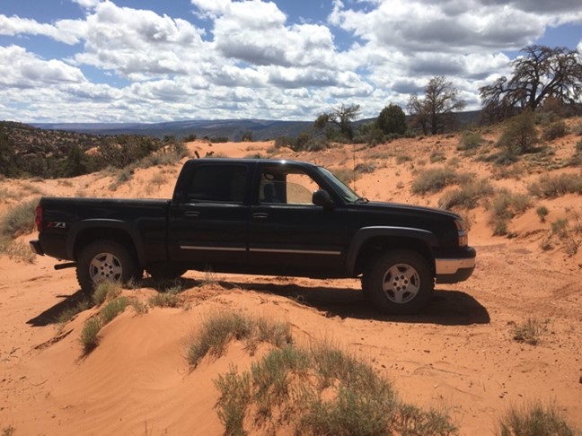
Scott’s truck on the Vermillion Cliffs plateau
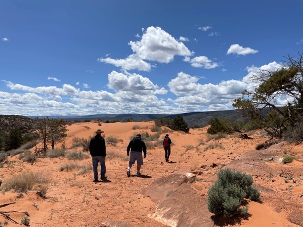
Looking for arrowheads
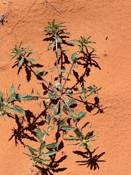
I am fascinated by the crisp shadows on the red sand
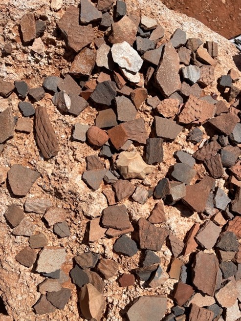
Many pieces of Indian pottery collected on rocks by former visitors
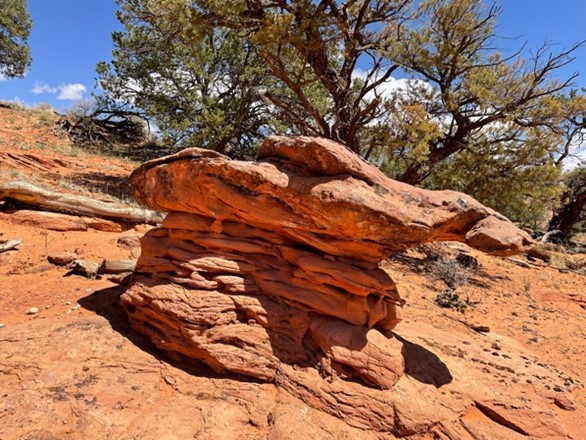
Interesting rock formation
Many bigger and smaller slot canyons can be found in the area of Page. Some of them are marked as official trails. We decided to hike the 9 mile long Wire Pass Trail to Buckskin Gulch. In order to preserve the nature and keep masses of tourists out, one has to acquire a parking permit the day before the hike.
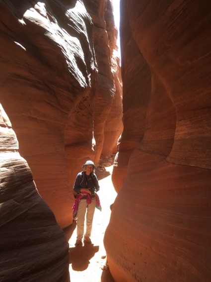
Wire Pass trail to Buckskin Gulch
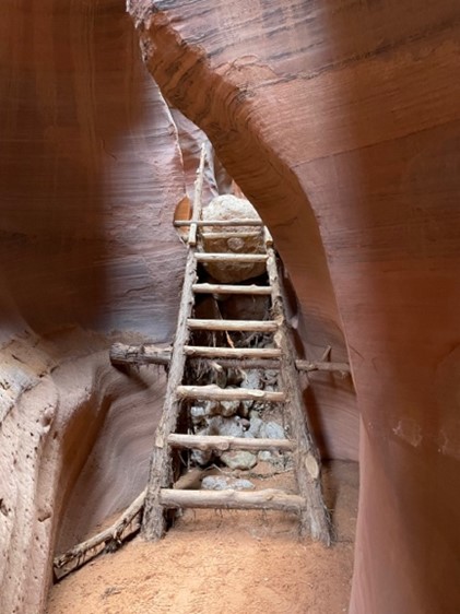
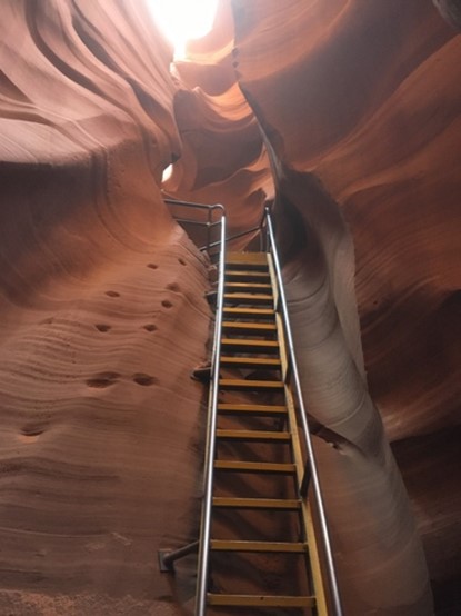
Climbing through the narrow canyon on ladders
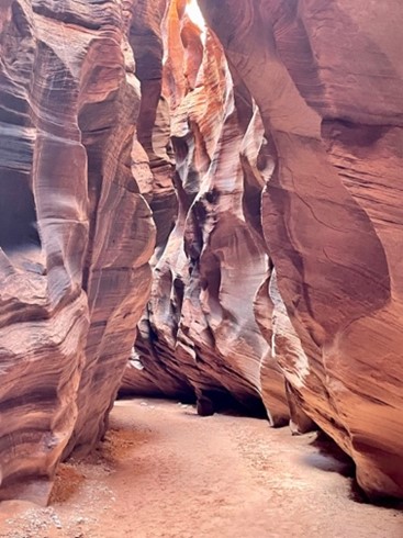
Breathtaking!
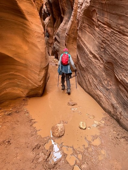
Balancing on sometimes wiggling rocks over knee-deep water
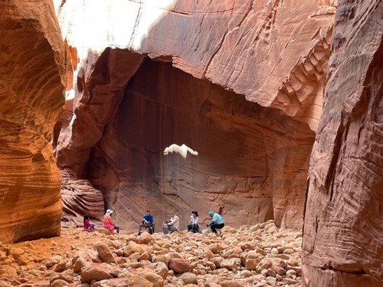
Strange, white formation over a resting group of people
More stunning impressions with Billie walking in the front
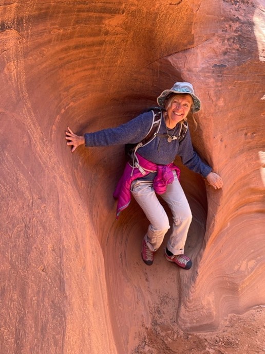
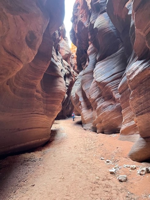
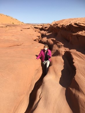
Climbing up the slippery sandstone and having fun
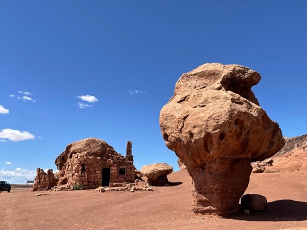
Stone formation beside Highway 89A
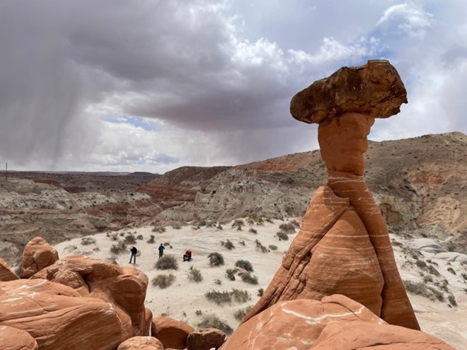
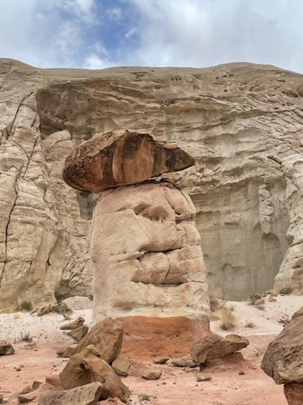
Toadstool Hoodoo
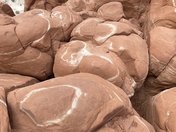
Interesting circles on the bottom of the Hoodoo
I called this rock formation “Laughing Buddha”
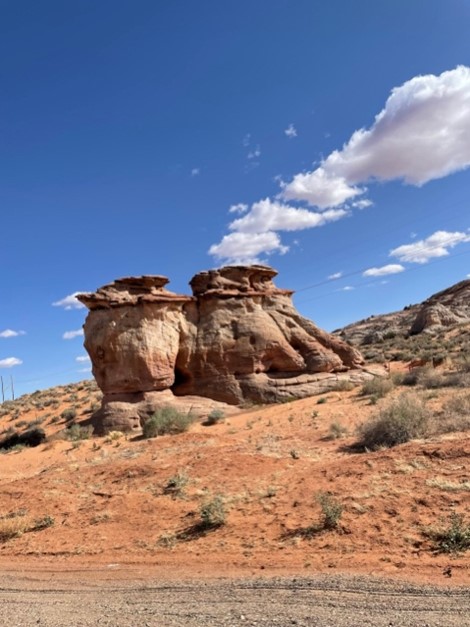
Rock formation beside the road – I called it 3 sisters
When I lived in Arizona, I always wanted to visit Antelope Canyon in Northern Arizona (1993 – 1999). At this time, the slot canyons were not considered a major tourist attraction and one had to rappel into the canyons. Then a terrible tragedy made the news around the world. 11 international tourists where trapped and drowned by a flash flood in Lower Antelope Canyon on August 12, 1997. Now, the Lower and Upper Antelope Canyons are run by the Navajo nation who manage the access to the canyons and make sure that the Canyon is safe to enter.
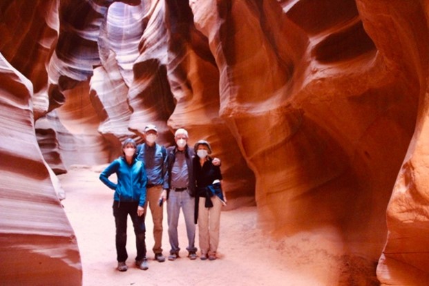
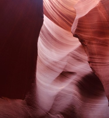
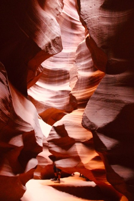
We visited the Lower and the Upper Antelope Canyons, each time with different Navajo tour company. Wearing masks was required, as the Navajo suffered from a lot of Covid deaths. Both slot canyons are spectacular and the photos do not even remotely represent the beauty of colour, light and shade and especially the formations. It is very difficult to take good photos in the canyon, as the difference between the bright sky above and the darkness in the narrow canyon is extreme – so you only get a taste of the beauty.
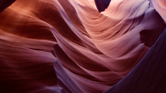
The waves in the Navajo sandstone were formed by million of years of flooding.
Signs of past floods could be seen either on the ground or high above. The force of the water rushing through the narrows is unimaginable.
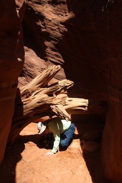
A powerful tree trunk at the bottom
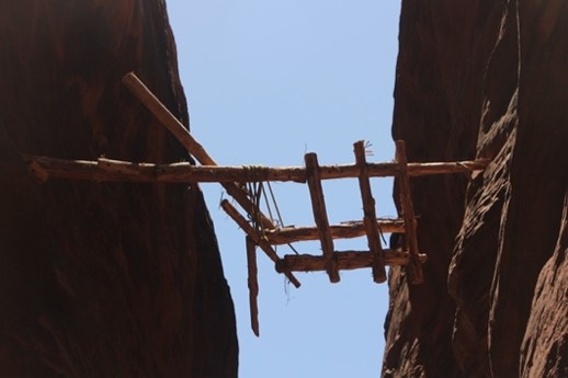
A former wooden gate in between the narrow rock walls
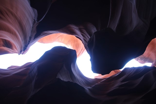
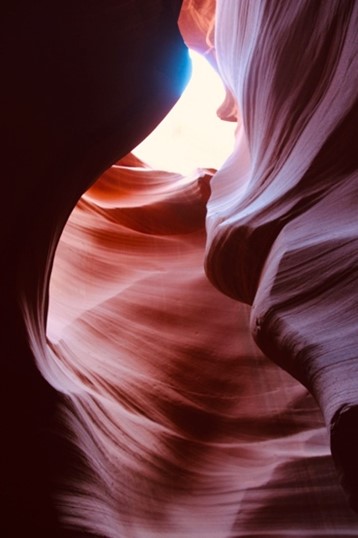
Looking up to the sky where only a sliver of light can be seen
Sometimes the wind blows fine sand into the canyon and settles everywhere
Every corner is a miracle of the forces of water, wind and light
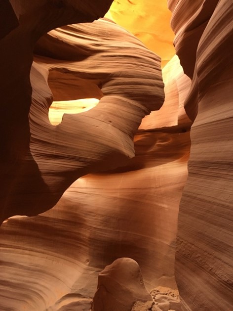
Often the guide pointed out specific formations, like a bear or the head of Abraham Lincoln. The formation above is like a woman’s head.
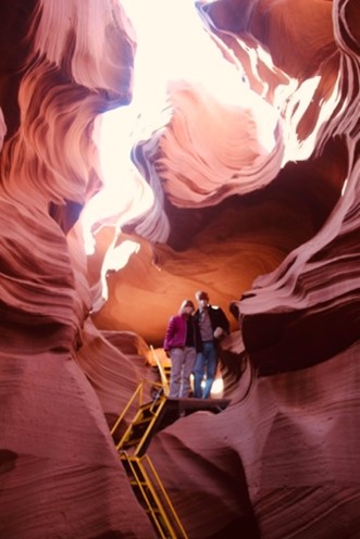
Stairways lead into the canyon and later up again.
This narrow slot is the exit of the Lower Antelope Canyon
When returning to Phoenix, we took a little detour and visited the Grand Canyon. I had not been there for over 20 years.
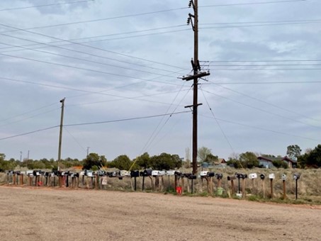
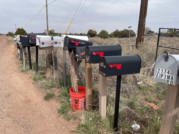
A row of mailboxes, typical for the countryside in the West
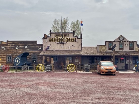
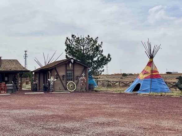
Beside the road, a trading company where tourists can buy native American jewellery and other things of the Wild West.
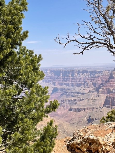
When we arrived at the Grand Canyon, we stopped at some viewpoints and looked down into the breathtaking canyon carved out by the Colorado River over millions of years.
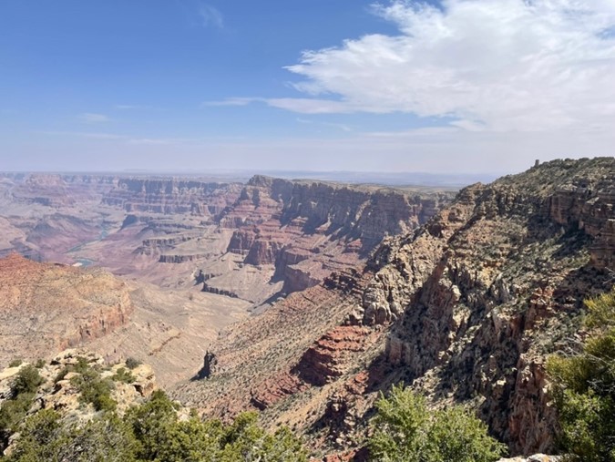
Huge parking lots created for the masses of tourists visiting the Grand Canyon every year could not ruin the beauty of the canyon – but it was disappointing to see how mass tourism is changing the pristine character in some spots.